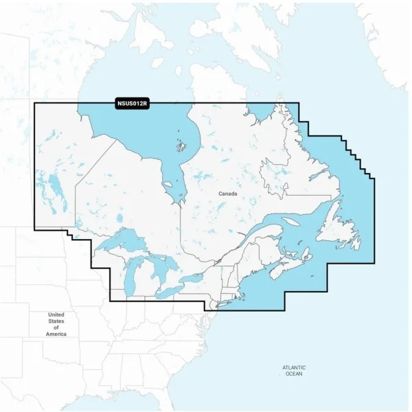
Garmin Navionics Plus Marine Charts Canada East Great Lakes microSD 010-C1484-20
USD $149.99
- Condition:
- New
- Shipping:
- Free Shipping
- SKU:
- 010-C1484-20
- Categories:
- Consumer Electronics / Vehicle Electronics & GPS / GPS Accessories & Tracking / GPS Software & Maps


Price alert
Notify me when the price drops
Description
Manufacturer description all-in-one map solution for garmin chartplotters access detail-rich mapping of coastal features, lakes, rivers and more. integrated garmin and navionics content offers coverage for boaters worldwide. daily chart updates charts are constantly being enhanced with new and amended content — as many as 5,000 updates are made every day. the one-year included subscription gives you access to daily chart updates via the activecaptain app. auto guidance+ technology built-in auto guidance will search the attributes of all relevant charts along with frequently traveled routes to suggest the best course for navigation taking into consideration your desired safe depth and overhead clearance. up to 1' contours for improved fishing and navigation, up to 1' contours provide a clear depiction of bottom structure for improved fishing charts and enhanced detail in swamps, canals, harbors, marinas and more. shallow rater shading to give a clear picture of shallow waters to avoid, this feature allows for shading at a user-defined depth. raster cartography noaa raster cartography is available for some u.s. waters as a free downloadable feature via the activecaptain app to provide paper chart-like views on your plotter. activecaptain community community-sourced content provides useful pois, such as marinas, anchorages, hazards, businesses and more. get recommendations from boaters with firsthand experience of the local environment. features detailed coverage of coastal and inland waterways of eastern canada (except yt and nu). coverage includes all the great lakes, the st lawrence river, the maritime provinces and the grand banks.
Market history
Price Tracking
Related picks